 |
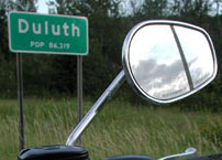
| From Bemidji, I headed east on US 2. First stop, Duluth, MN
in 140 miles. |
|
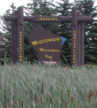 |
Shortly after Duluth, it was back into Wisconsin again.
Being familiar with Northern Wisconsin and now knowing that I
would be getting to my ending point no sooner than 1 AM (about 2
hours late), I became very concerned about finding gas stations
open when and where I would need them. I knew that my
final stretch would be into the Michigan UP and through areas
where there are no large towns. So, I decided that if I had
anywhere near 70 miles since a fill, and I came to an open gas
station I would stop. It would make the trip longer, but I
did not want to run out of gas in the middle of nowhere on a
moonless night in the north woods. Of course I again found
more stations that did not print location or did not time stamp
receipts, making the gas stops take even longer. |
|
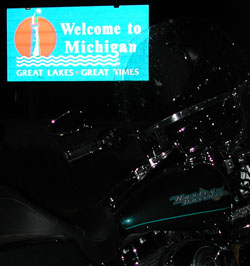 |
As you can see it is now dark as I entered the Upper
Peninsula. I was now just looking forward to getting to the end.
Then the big surprise, the final 40 mile section of US 2 that I
needed was closed! (Yes I did check road construction with AAA, but I
somehow missed this one.) The posted detour
would have taken me about 40 miles north (in the wrong direction), so I
pulled out the map and decided to make my own detour south on small
county roads. I am not sure now if that was such a smart idea, and
going the extra 40 miles may have actually been faster. The roads I
ended up on were narrow, winding things going through deep forest.
The small towns along the way were closed up for the night. Not a soul
in sight. Thankfully no deer either.
At my last gas stop before the end in Eagle River all I had available
at nearly midnight were stations with automatic credit card pumps, but
no attendant. So of course the one I stop at does not print the city.
So, I go down the street to another one and put in $0.10. That
pump prints city and date but no time. I hope that my explanation
of the circumstances will be acceptable for documentation. |