July 31 to August 15, 2010
Saturday July 31
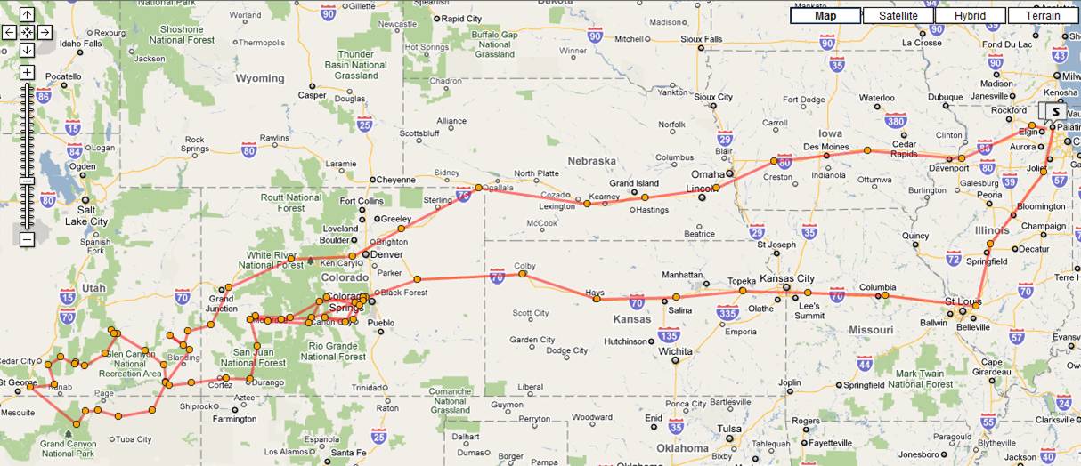
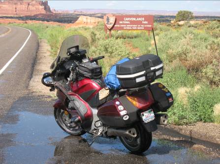
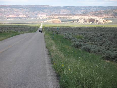
I ended up leaving Palatine around 2 PM after a little battery problem, the ST started a little slow the first time and then I needed to charge up the battery before leaving the driveway as it would not start the second time. I attributed this to my aiming the driving lights the previous evening in the driveway, engine idling which did not pump enough charge into the battery, and me forgetting to plug the battery tender in overnight. I pulled out of driveway to head south, and the battery gave me no further trouble (at least for a while). More to come on this. Saturday was your basic freeway cruise, getting as far as mid-Missouri on I-70.
Sunday August 1
Sunday I had about
From here on out it was a long hot day, with temps in
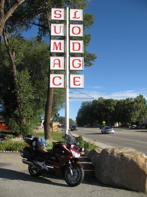
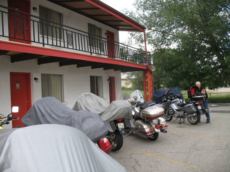
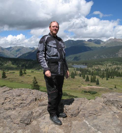
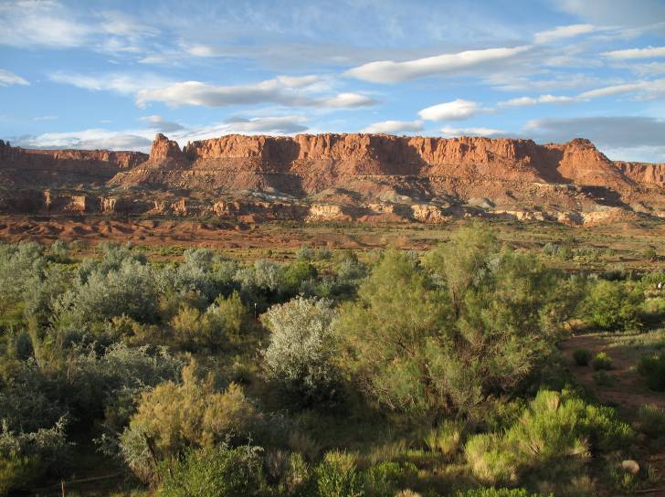
I stayed at the Sumac Lodge until Thursday morning with the Motorcycle Tourers Forum crowd. Note that the pictures below are from later days, and not the exact time I pulled in, which is why the sky is blue rather than dark gray.
Monday August 2
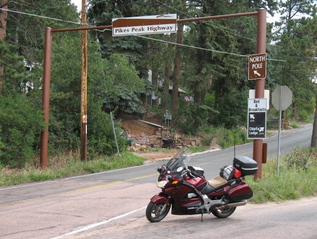
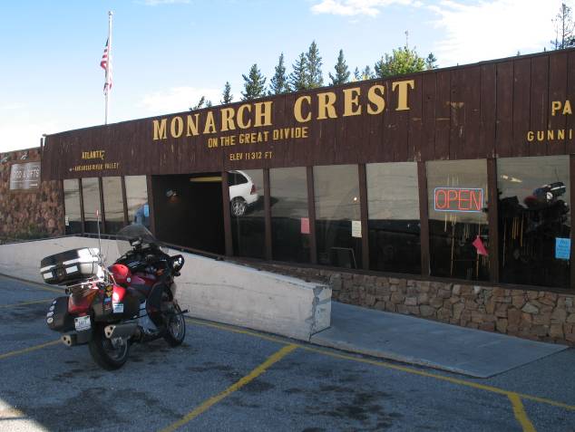
Monday was a ride out and back on Hwy 50 to the
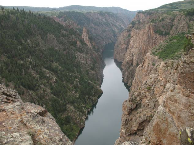
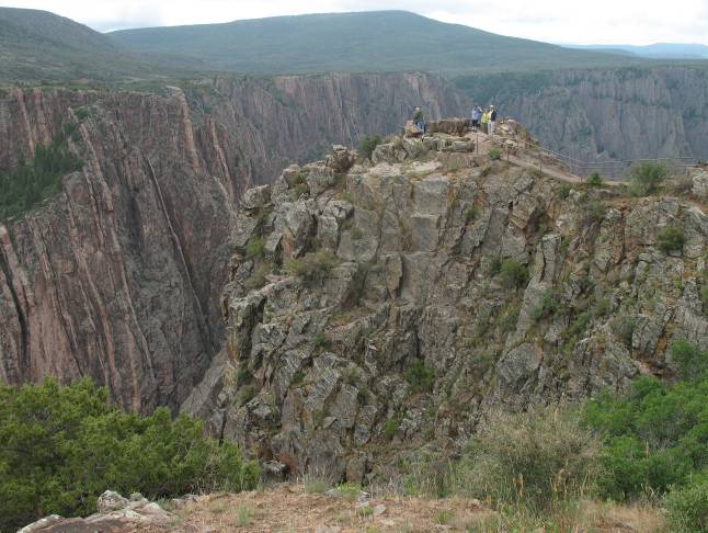
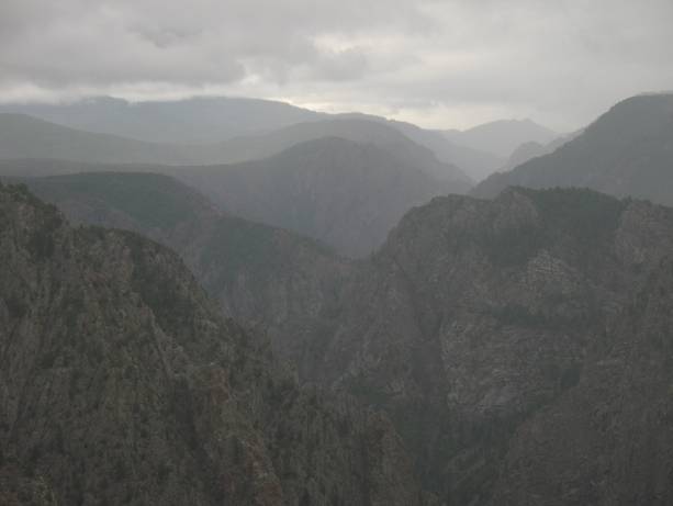
Overlook at the
It was another cold wet ride back to
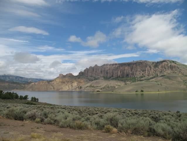
Tuesday August 3
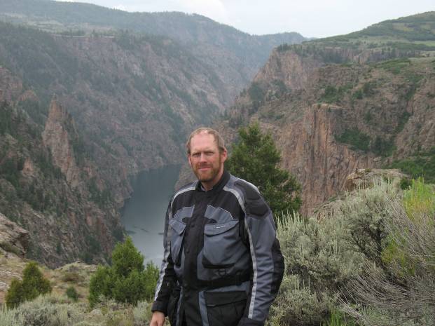
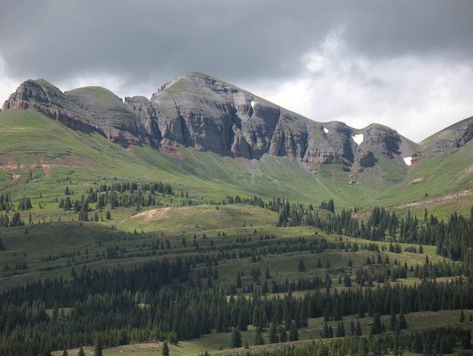
Tuesday was a ride to the east to go up
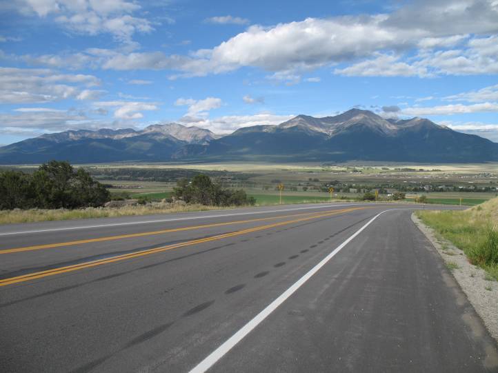
Several riders tried to go up
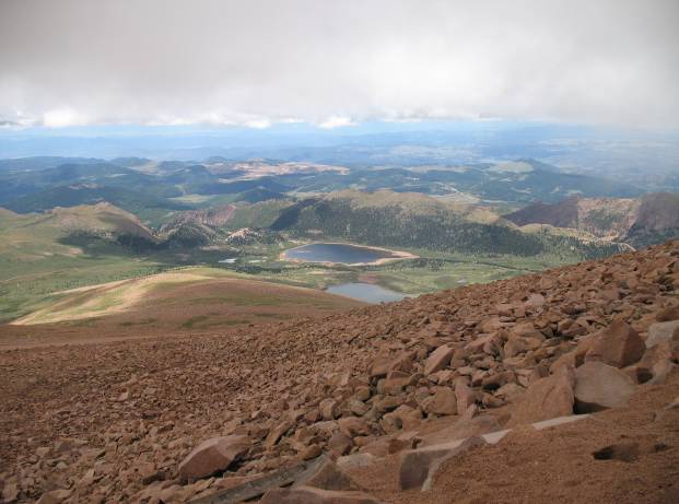
Heading up to
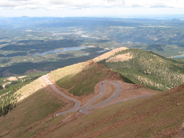
It is quite a road to the top.
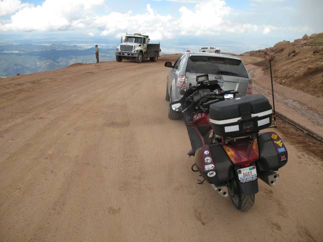
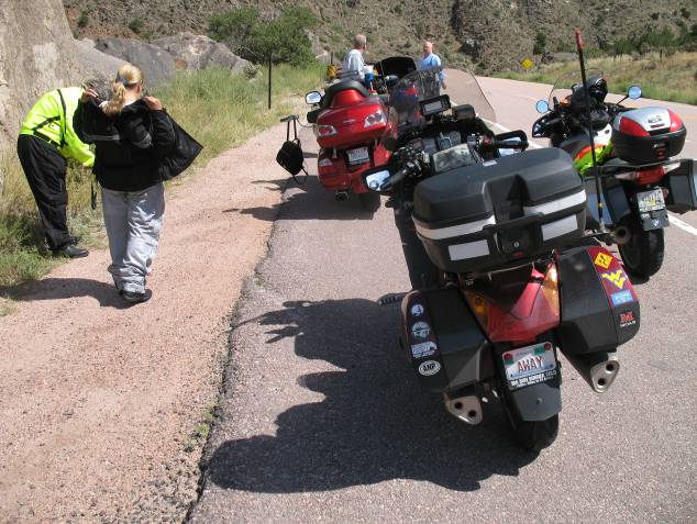
Like everywhere else, it is under contruction. Here I am waiting for the
flagger.
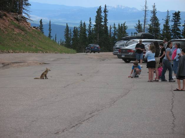
A fox in the parking lot at the half way point. The storms were waiting for me on the
way to Buena Vista
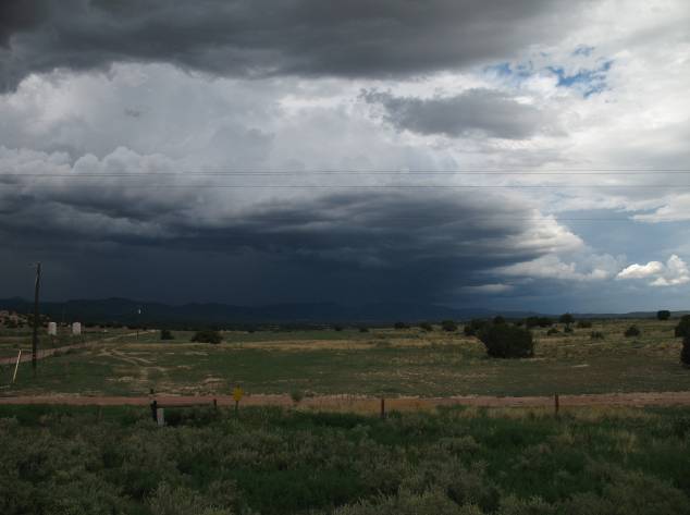
Again the rain found me, and this time it was an absolute
downpour. So much that I had to go
around the street flooding in
Wednesday August 4
I went with Grizz and John and Jim back down Hwy 50 towards
Canon City (this time with no rain), and took some back roads to
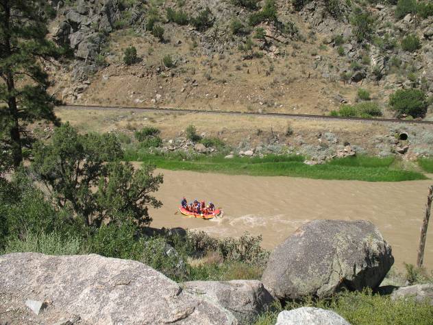
While stopped along
Hwy 50 some rafters were going by.
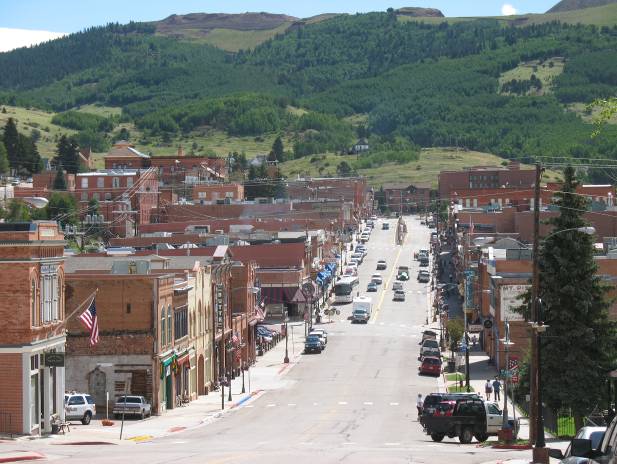
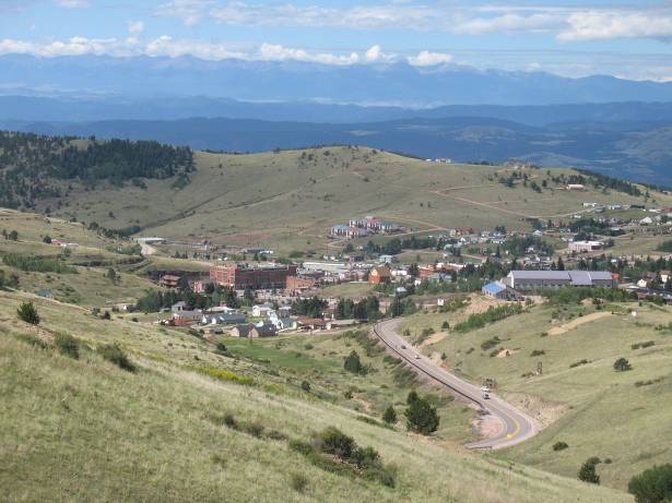
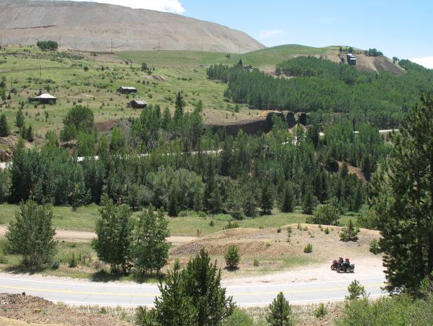
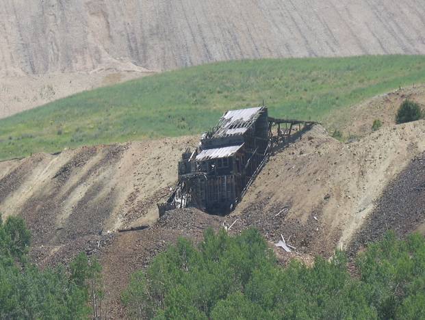
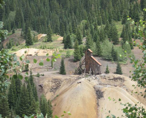
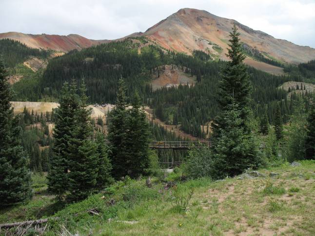
The town of
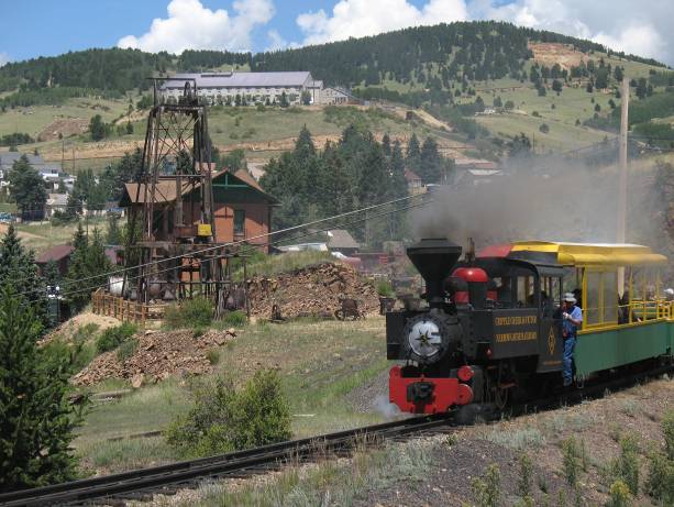
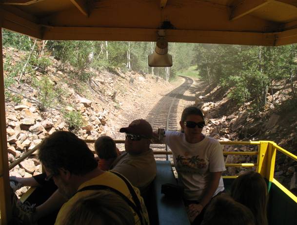
We stopped to take the narrow gauge railroad ride up into the hills among the abandoned mines.
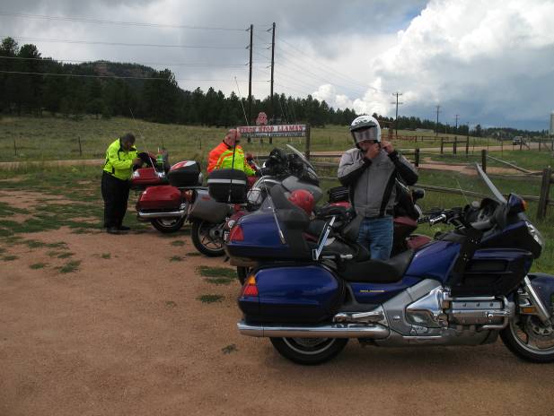
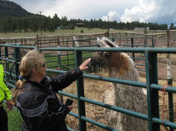
Jim’s house was just a few miles away and we made a stop at his neighbor’s llama ranch.
We stopped by Jim’s house for a short visit, and then with
clouds gathering in the west and thunder rumbling, we got on the rain gear
anticipating a wet ride back to
Thursday August 5
Time to head out from
I found a nice gift for my wife, and it was now that the
battery decided to give me notice that it was nearing the end of its life. When I came out of the shop the bike barely
started. The voltage went so low that
the dashboard computer went dark and the trip odometer reset to zero. Given what happened when I left home the week
before, and now this, and that my next week would be in the open spaces of
southern
With a new battery in place I headed for Ouray and a ride
down the
First stop was The Heart of the
Next a stop at one of the summits along the way.
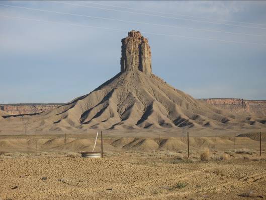
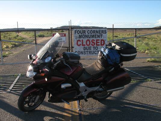
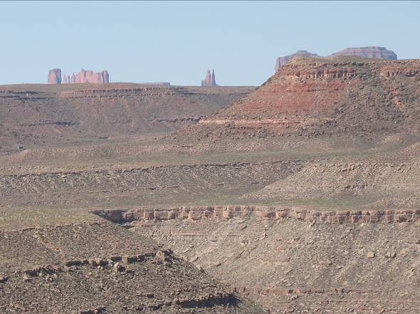
My tour through the southwest then started in earnest with a run to the four corners. When you start seeing land forms like this by the side of the road you know you are getting close. Seems like the four corners monument is closed a lot longer than its website indicated as the original plan.
I had a totally enjoyable ride up from the four corners to
Friday August 6
The first day in the heart of southern
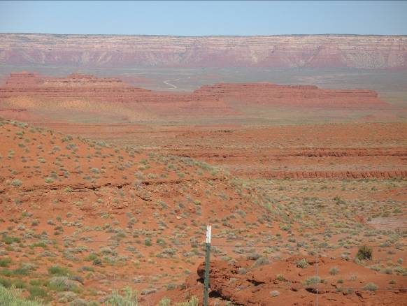
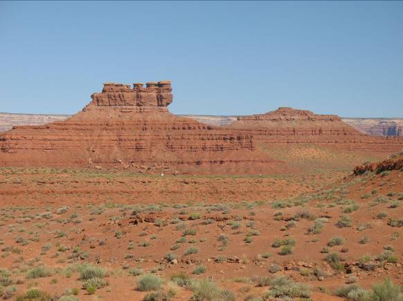
Then I turned up hwy 261 with a stop a
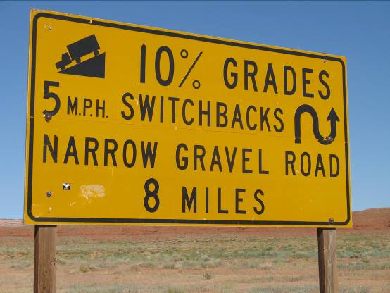
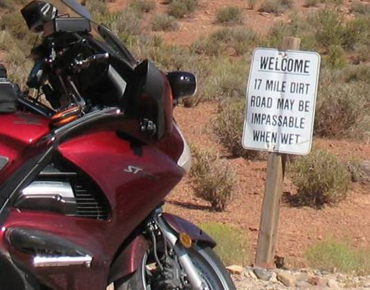
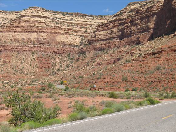
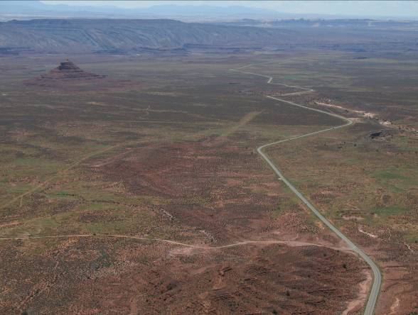
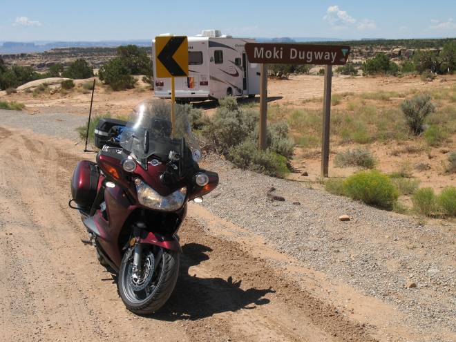
Next, continuing northward to the Moki Dugway, with this warning of what is ahead. Just before the dugway starts there is a turn-off to an unpaved road that loops through the Valley of the Gods. I went down the turn-off about 100 feet and briefly considered taking this road, but I saw puddles of water and then I saw this sign… Considering all the rain I had seen in the past week, I turned around back to the pavement and continued on to the Dugway.
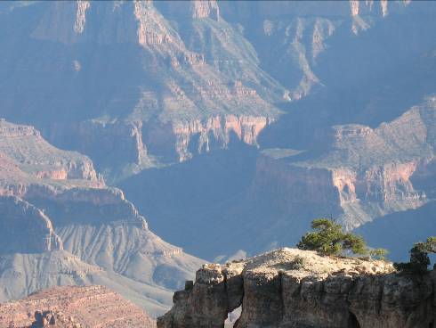
The Moki Dugway is an impressive road When you approach it from the south it looks
like you are heading straight into a sheer cliff and it is not obvious where
you are going to go. Just half way up the view is amazing.
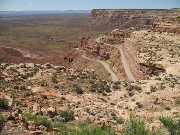
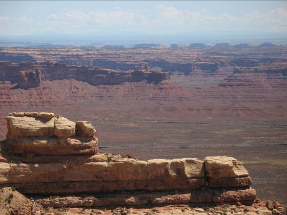
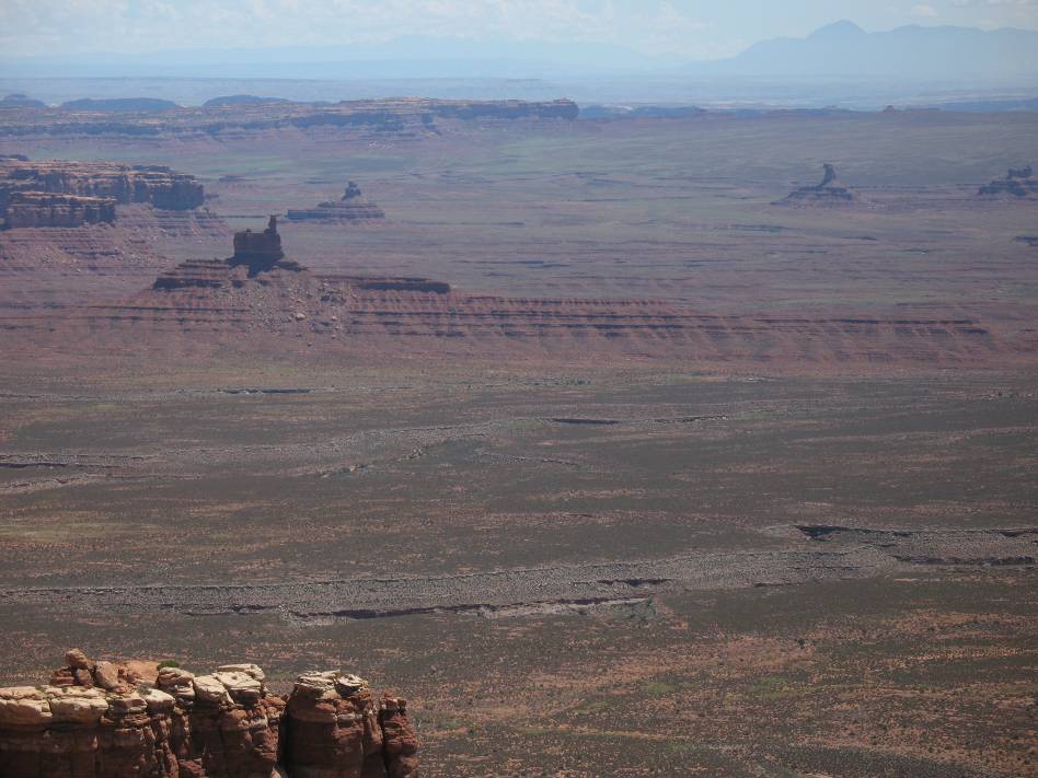
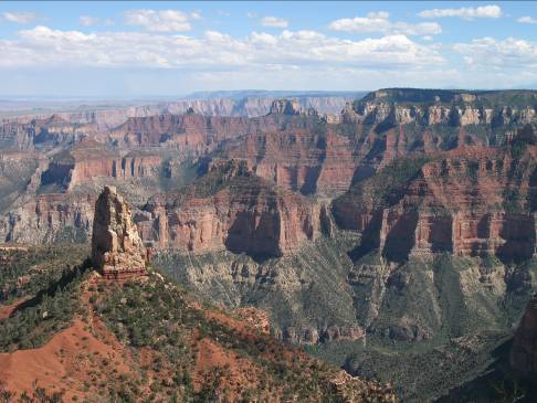
At the top of the dugway I took the picture below. The
following week at the IBA meet in Denver Claye (who had been following my SPOT
tracker page) comes up to me and says
“Did you get THE picture?” I had no idea
what she was talking about. The picture
below is THE picture. What I did not
know was that this was the location of the MTF tag picture that has been
waiting a year for someone to pick up. I
promised Claye that I would find a good place on my way back to
For those on the ST forum, I stopped at the Putt memorial to contemplate the scene before me and put some thoughts in the book.
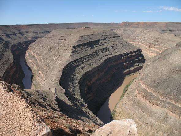
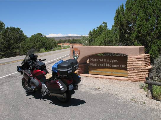
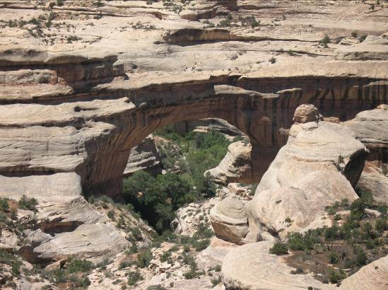
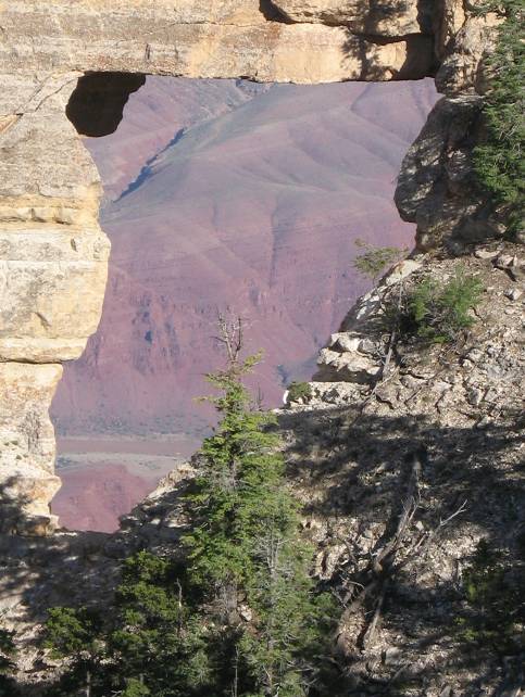
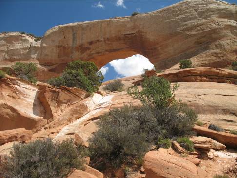
Continuing north, I took 261 and then 95. I stopped at Natural Bridges National Monument. The views from the road are OK but to really see it you need to take hikes of several miles to get down to arches. I did not take the time to do that.
I think that Hwy 95 northbound to Hanksville is the MOST
scenic road of my entire loop of southern
At the north edge of
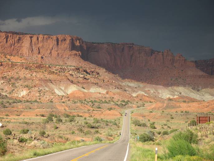
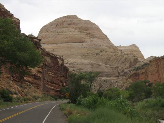
Heading from Hanksville to Torrey winds through landscapes that are gray and look almost lunar. Then I crested the hill and there was Capital Reef.
As I headed through Capital Reef NP, I could see the rain coming and hear the thunder rumbling. I raced through the park to get to the hotel before the rain came down, I did not want to get caught in a downpour EVERY day. The plan was to go back to the park in the morning before the rains came.
I checked into the Best Western Captial Reef Hotel, and found this scene from the balcony of my room. This picture is about two hours after the previous one, when the rains moved on.
Saturday August 7
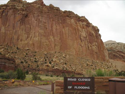
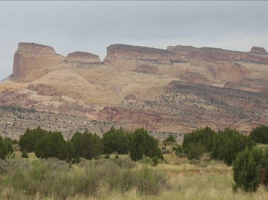
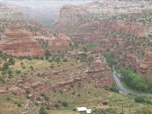
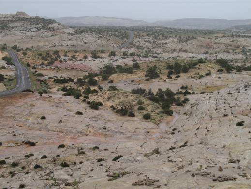
As planned I went to Capital Reef park. As turned up the scenic drive in the center of the park I could already see dark clouds to the west, but I pressed on. There was clear evidence of the douwnpurs that came through yesterday, with lots of sand on the road where the water was flowing across it. Nice views, but by now I was hearing thunder in the distance. I got to the end of the drive, and the unpaved road into Capital Gorge was closed due to flooding and impassable mud, even for four wheeled vehicles. At this point it started to sprinkle a little rain. I did not want to get stuck crossing all of that sand when it becomes mud again, so I cruised on back to the main road. The overall look of Capital Reef reminded me very much of Zion NP with its sheer red cliffs.
I ran the video camera for a part of this ride rather than stop for many pictures.
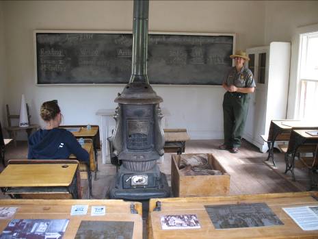
A little way down the road was the historic Fruita one-room school. This school was in use from the early 1900’s to 1941 and taught first through eighth grades. It was founded by the Mormon’s who settled this area starting in 1880.
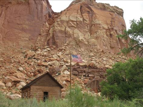
Why would this place be called Capital Reef? Each word has a history. “Capital” is because of rock formations with white domed tops that made the early settlers think of the capital domes in the cites they left in the Eastern US. “Reef” is because many of the early settlers came from a sea-faring background, and to them a reef was something that stood in your way. The “reef” in this case is a waterpocket fold of rock that is about 100 miles long and would require a long detour for the early settlers with their wagons.
Now it was time to head west down the famous Hwy 12 toward Bryce Canyon. Here is where I found the downpouring cold rain for today. Initially the views along the way were just gray fog. Eventually the clouds lifted enough to see something, but the rain continued until past Escalante.
I stopped by the National Park Service Visitor Center in Escalante around 2 PM. There had been so much rain in past week that notices were posted that essentially all of the unpaved roads in the area were impassable. One of rangers told me that it was highly unusual to have so many days of rain, usually they get a day or so, unlike this year with more than a week of rainy days. The ranger also told me that people were coming from Bryce that morning saying that the canyon was covered in fog and they could not see anything. I was hoping that the day would follow the same pattern as others where it would clear off near sunset which is when I would be at Bryce.
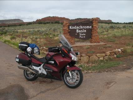
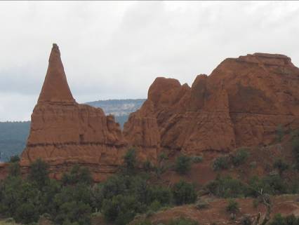
Before Bryce I made a stop at Kodachrome Basin State Park. It was still very gray and overcast when I was there. Under that totally flat light it is not nearly as scenic as the professional images show.
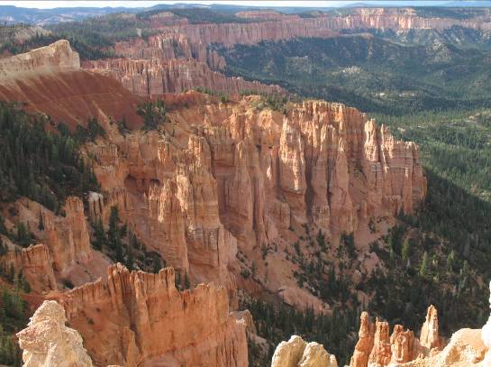
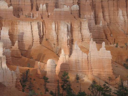
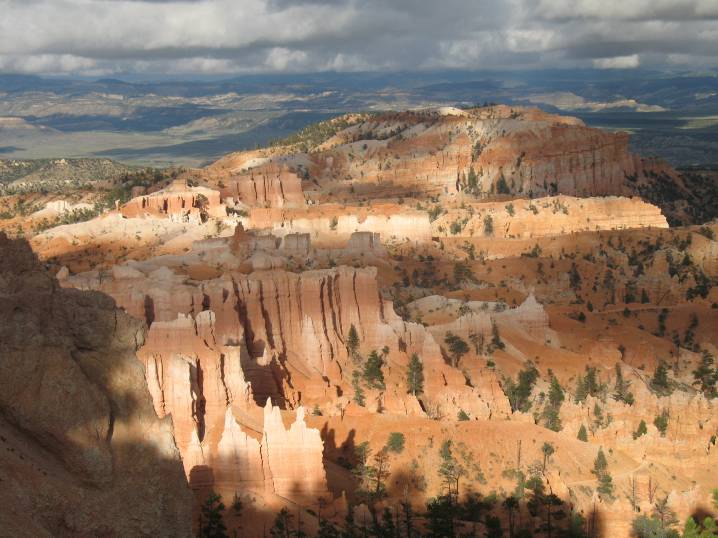
As I had hoped things had cleared up by the time I reached Bryce Canyon. I was surprised that there is now Bryce Canyon City (Established 2007) at the entrance gate to the park. The last time I was there with my wife about ten years ago there was only a small hotel, a small restaurant and a helicopter pad. Now there are several large new hotels, a small shopping center, and lots of room to park the tour buses.
Sunday August 8
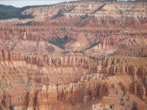
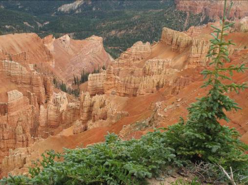
Destination for tonight was the North Rim of the Grand Canyon. I left Panguitch by 8 AM in an attempt to beat the rains to Cedar Breaks National Monument. It was a very nice ride on highway 143 from Panguitch to Cedar Breaks. A nice combination of mountain road and high meadows. I highly recommend a stop at Cedar Breaks. It has all the scenic beauty of Bryce, but without a city at the entrance gate, and without he tour busses. It was a cool and crisp morning there with the park being at just over 10,000 ft elevation.
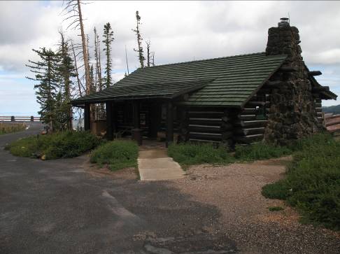
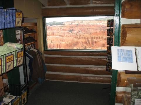
The visitor center is a simple log structure that sits right on the edge of the cliff and has a great view. (That is the window, not a poster.)
I took a walk down a trail from the visitor center area, and
of course as I am heading down the trail I start hearing thunder and shortly
see the rain coming over the hills in the distance. I went about halfway down the trail then
started feeling raindrops and turned around. As I headed out of the park and
down Utah 14 to US 89 the downpouring rain hit me again. Why is it named Cedar
Breaks? Early settlers called the area badlands
or breaks and combined breaks
with cedar for the many juniper trees in the area which were incorrectly
called cedars.
.
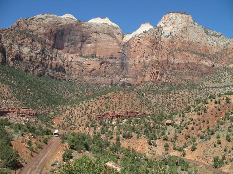
By the time I got south to Zion park it was sunny and warm. In summary, Zion Park is one big road construction site. Much of the road from the East Gate is being repaved and is currently dirt/gravel, and there were at least places that were single lane with a flagger. The visitor center lot was totally packed. I could not help myself again and had to stop for a park stamp, but the visitor center lot was totally packed. I got lucky and found a spot right up near the building with one motorcycle parked in it. I tucked the ST in next to the HD, and ran in for the stamp.
By this point I was hot and tired of going 10 MPH through construction zones so I did not linger, and just got on the road to Hurricane. I then took 389 east to 89A and then down to the North Rim.
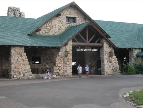
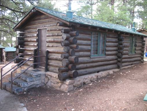
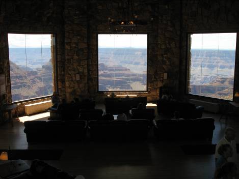
I stayed in one of the small cabins at the Grand Canyon Lodge. This is a great place. The same strctures that were built in the early 1900's by the Union Pacific railroad when they were using the national parks to drive passenger rail traffic to the west. It really gives you the feel of the history to stay in an original "real" log cabin, and not some new hotel with a faux log decor.
Monday August 9
I enjoyed my Sunday afternoon and evening at the north rim so much that I checked to see if I could stay until Tuesday morning. I was in luck that my room was open for another night.
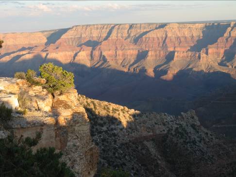
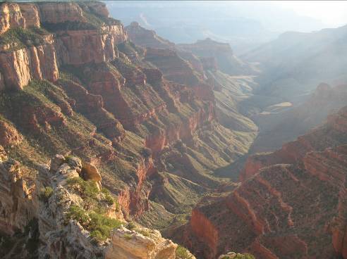
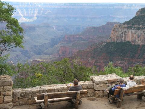
I just hung around the North Rim area on Monday and went to all of the view points.
Tuesday August 10
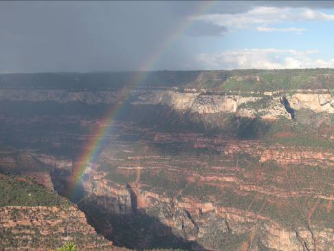
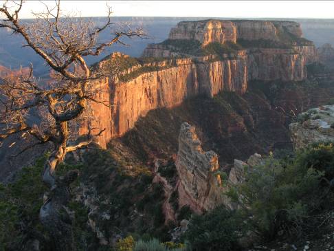
Before heading out from the North Rim I had breakfast on the sun deck overlooking the canyon.
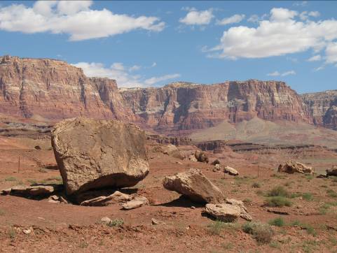
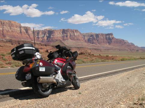
From the North Rim I kept heading east on 89A, stopping by the Vermillion Cliffs.
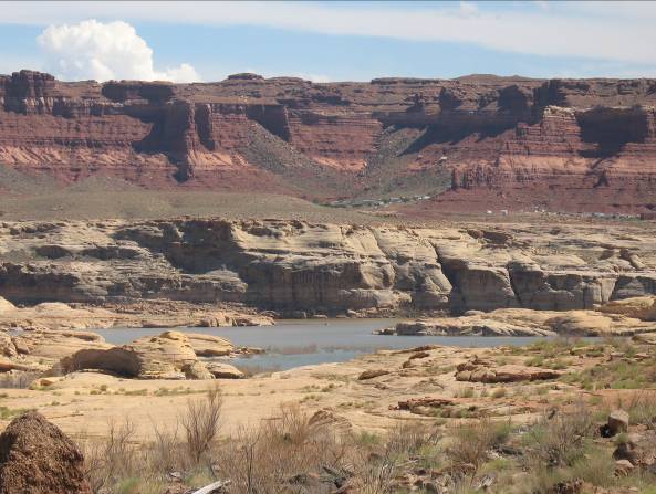
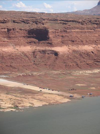
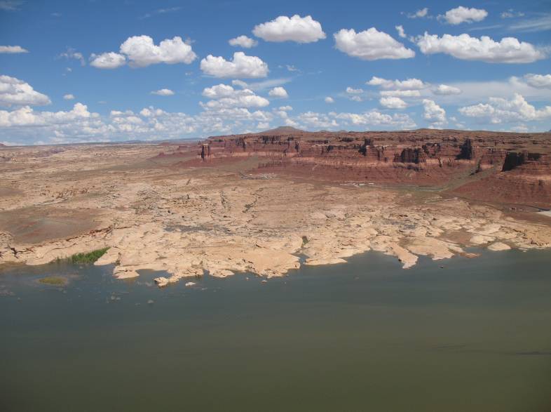
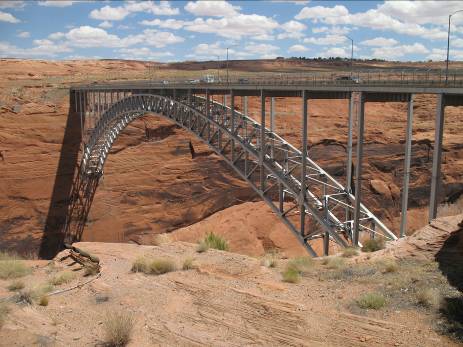
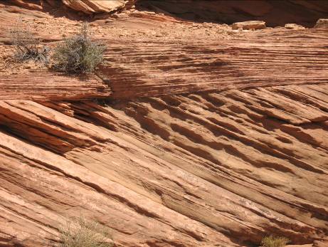
In the midst of this landscape of extremes you find an extreme example of manmade objects, the Glen Canyon Dam just outside Page Arizona.
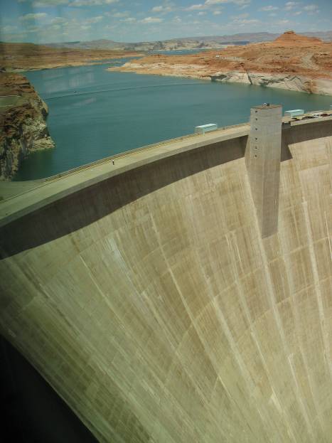
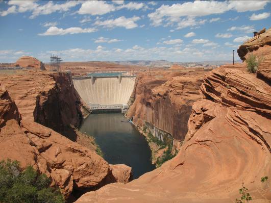
It is interesting to contemplate how difficult travel in the area was years ago before bridges like this at Glen Canyon were in place. The second photo below illustrates the geologic processes from the past with the sharply changed rock strata.
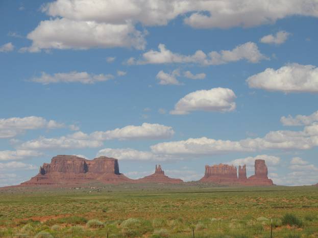
Continuing east, next stop monument valley.
I completed my day with my second run up the Moki Dugway,
and highway 95 to the east.
Come with me up the
Moki Dugway in this video: http://www.levar.org/photo_albums/summer_trip_2010/mokidugway.wmv
I ended the day at a small hotel in Monticello, UT. Finally a day with NO RAIN!!!
Wednesday August 11
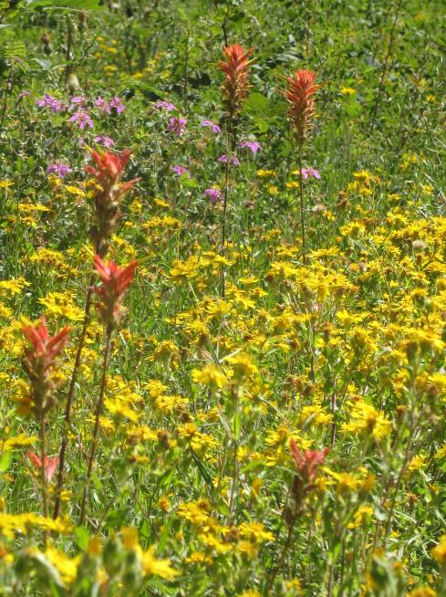
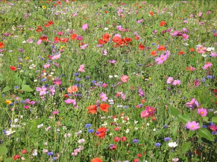
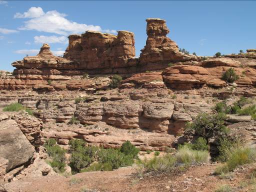
I started the day with a ride to the Needles District of Canyonlands National Park. As I was heading in toward the park I hit the brakes and turned around to take some pictures of a wildflower bed. It looked like an area was fenced off and the rancher planted a wildflower bed. It was one of those moments when you see it as you sail past. As I headed down the side road to Canyonlands needles the dark clouds closed in and I rode through another downpouring rain. You can see the wet pavement at the national park sign.
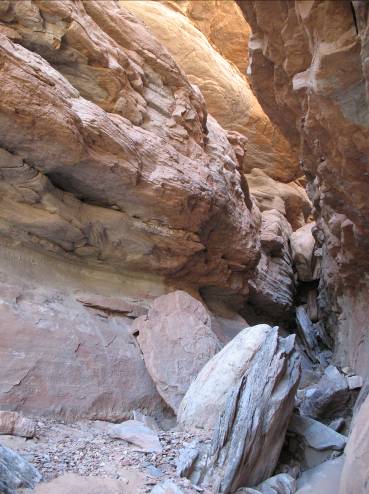
I went down to the end of the scenic drive, and took a little hike. I found a small slot in the rocks for a cool picture. The other image is looking back toward the parking lot.
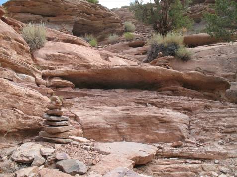
The trail is marked with cairns, or small piles of rocks. It would have been nice to hike out to the confluence of the rivers, but that would be a 12 mile hike. I was not up for something that long. The other picture is the view to the east heading back to the main road.
You do not have to look to hard too hard to find unique formations. Driving north on Highway 191 right next to the road is Wilson Arch, named for an early settler who had a cabin nearby. I think it would be very cool to have an arch in your back yard…. Pics are Wilson Arch and looking back toward the road from Wilson Arch.
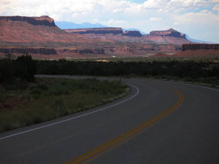
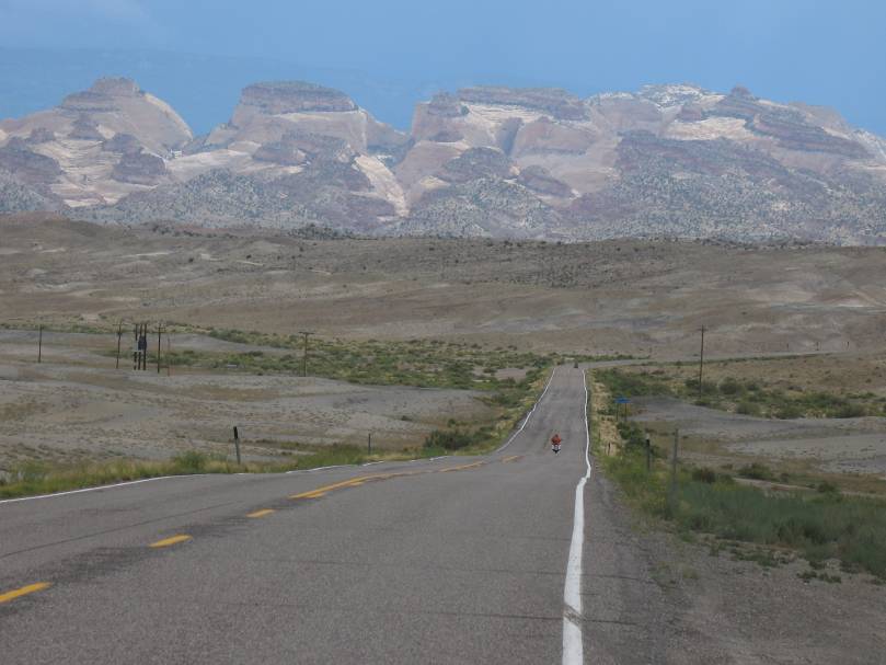
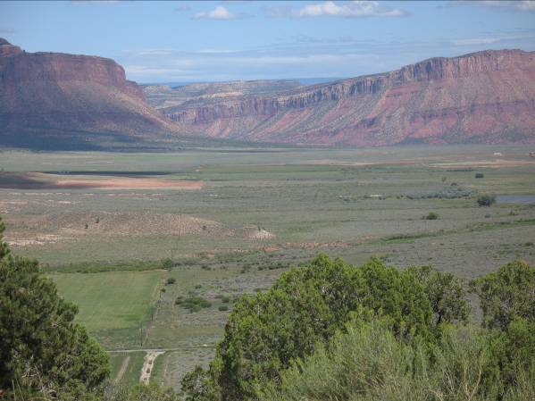
I turned east on UT 46 to begin the run to Denver. From my trip down UT-46/CO-90 I was looking forward to going through the Paradox area.
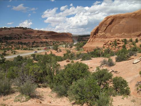
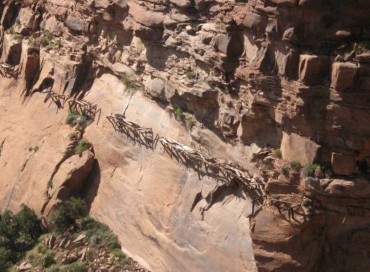
I turned north on CO-141 toward Grand Junction. CO-141 from Naturita to Grand Junction is a fantastic ride. Nice sweeping turns, good pavement and light traffic. An added plus was great weather, sunny and not too warm. Other than great scenery, the road goes by the ruins of the Hanging Flume. A mining company needed more water for their operations and between 1888 and 1891 built a 13 mile canal and flume to bring in water from the San Miguel river. The last 5 miles of the flume was hung from the canyon wall above the river. Unfortunately the mine was never profitable, and was abandoned a few years later.
At Grand Junnction I got on the interstate eastbound, and again the dark clouds, rain and lightning were nearby but did not come over the interstate. I stopped at Glen Springs for the night. While was out trying to find dinner the rains came out of the hills in more huge downpours.
Thursday August 12
The goal today was to get to Denver to the Marriott Tech Center for the Iron Butt Association National Meet. Since I came through the Eisenhower tunnel two years ago, I decided I would take Highway 6 up and around over the pass. This is when the rains showed up again. Essentially the entire time I was climbing and descending the pass it was pouring rain and temperatures dropped to nearly 40 degrees. I did not take too much time on the pass, I just wanted to get back down where it was warmer. By the time I got to Denver at 1 PM it was 85 degrees.
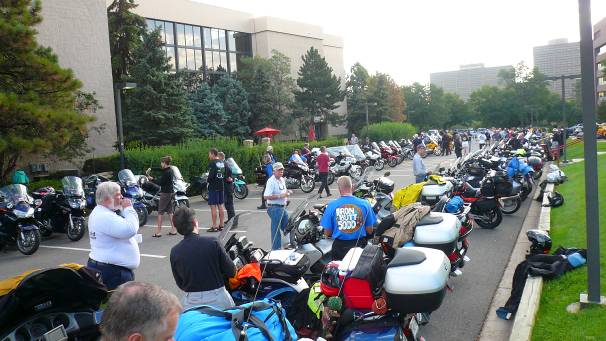
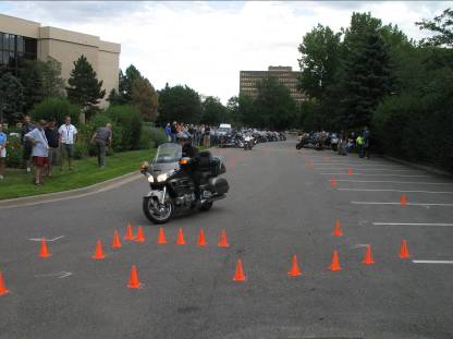
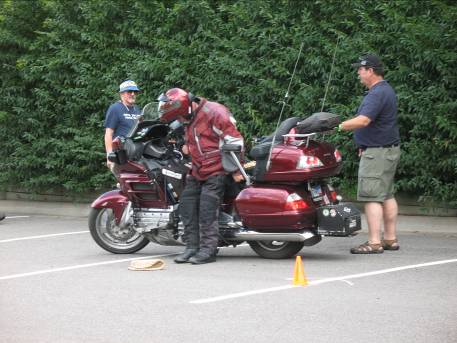
Later in the afternoon some courageous folks tried their skills at on the Motorcop cones range in the parking lot of the hotel. Several people had problems staying upright but that was understandable as it was quite a squeeze to fit a Wing through the tight cones.
Friday August 13 and
Saturday August 14
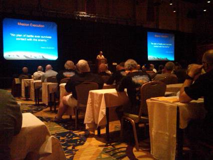
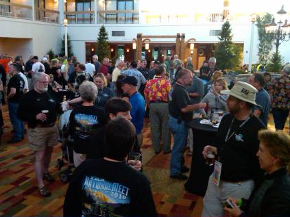
The IBA meet was a great time, sort of a cross between a really big RTE and an industry trade seminar for long distance riding.
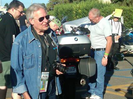
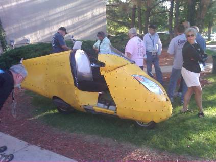
One of the highlights was having Craig Vetter there as a dinner speaker, and showing his latest project, the “streamliner” scooter.
Sunday August 15
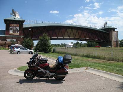
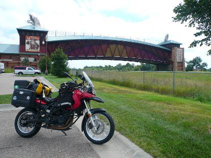
Basically a 1000 mile day on I-80 to get back to Palatine, IL. I had one stop to make along the way. Since I had taken the tag picture at the Moki Dugway, I had to stop somewhere to take a picture of a landmark to move the tag back east. I stopped at the Archway Monument museum at Kearney, Nebraska. Before I left Denver, I had talked with Claye. The plan was set that she would stop by the Archway on her way back to the east coast several days later and move the tag along further east. Below are my picture and Claye’s at the Archway.
I pulled in the driveway at around midnight after 15 days and 5300 miles.. Starting and ending it with group activities and then a week of solo touring in the middle was a perfect balance. A truly great trip (except for the rain).