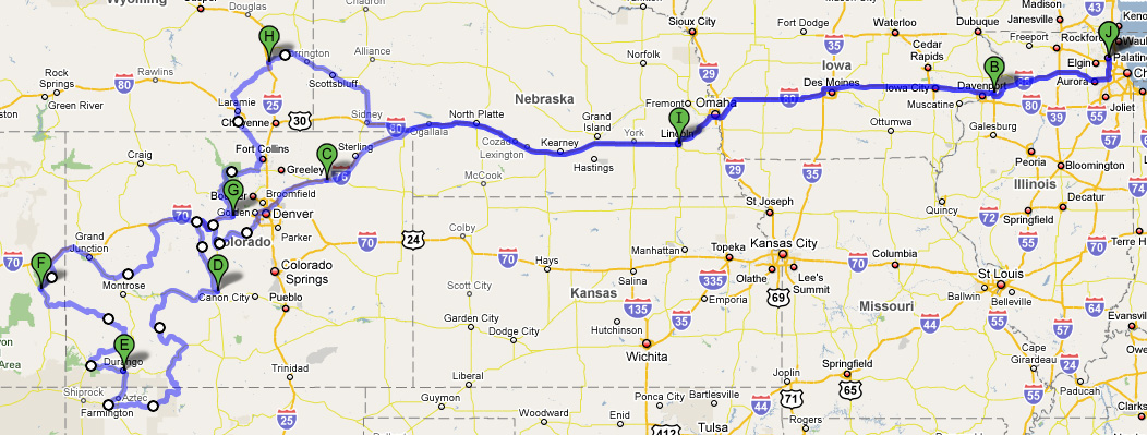
George's Summer Trip 2008
July 31 - August 9
July 31
Some last minute things for work had me leave a couple of hours late, at 6 PM. My goal was to make it to Iowa. I stopped an Le Claire, IA, at a Super 8 on the west bank of the Mississippi
August 1
My goal was to make it to Denver about 800 miles away. It got hotter and hotter as I went west. I stopped for a late lunch at Ogalalla, NE, a return to my turnaround spot from my BBG. I stopped at Fort Morgan, CO, 80 miles east of Denver. It was 97 degrees at 7 PM. As I rode along I noticed how HUGE the irrigation rigs are in Nebraska. When I crossed into Colorado it was like flipping a switch from flat land to rolling hills.
August 2
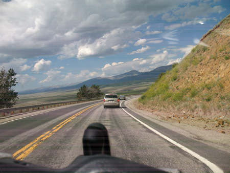
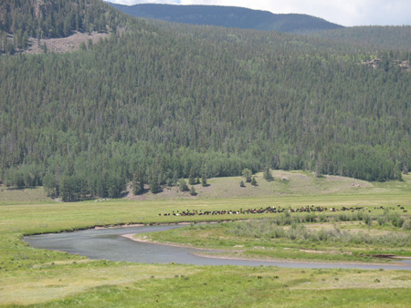
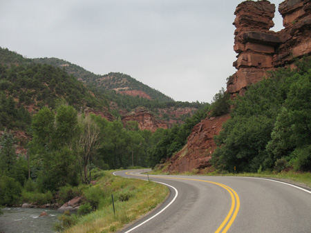
Another early start. Denver was supposed to hit 100 degrees and I wanted to be in the mountains before then. Based on the traffic heading west from Denver, everyone else in Denver had the same idea. Highway 285 out of Denver was a constant stream of traffic including RVs, semis, and two halfs of a prefab house being moved somewhere. Went up through Breckenridge, which was packed with people enjoying the cool temperatures. US 24 (Top of the Rockies) south from I-70 was gorgeous, however a construction had several sections that were unpaved. .
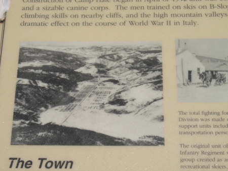
The Pando Valley was used in World War 2 as a base for training troops in mountain warfare. The units ended up using these skills in the mountains of Italy, and many of these men used their mountain skills after the war to build the ski industry in Colorado. You can still see the roads from the base on the valley floor.
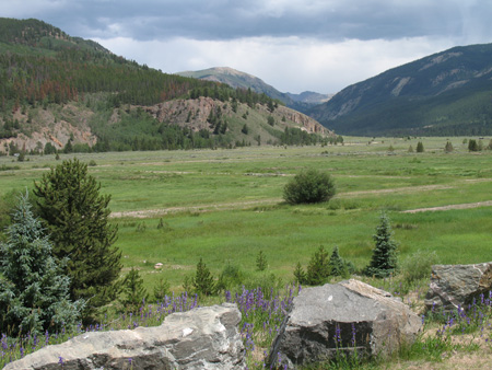
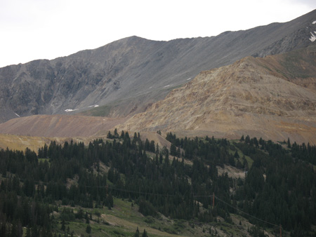
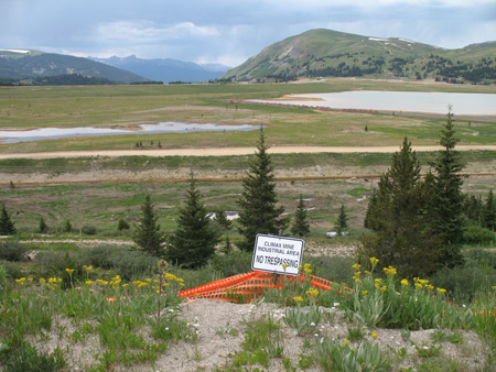
Went to Leadville, and did a quick up and back on Highway 9. The old Climax mine has quite a scar on the mountainside, and the valley area where all the tailings ended up is a major Superfund site.
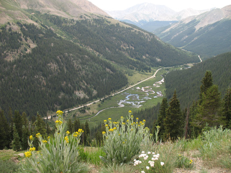
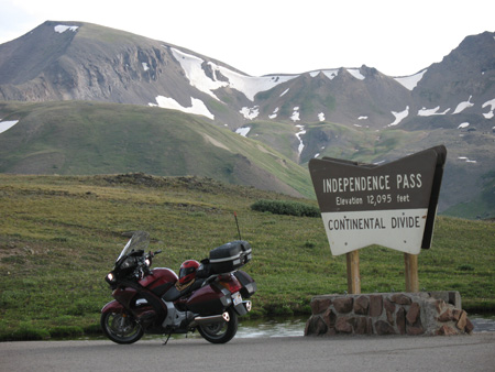
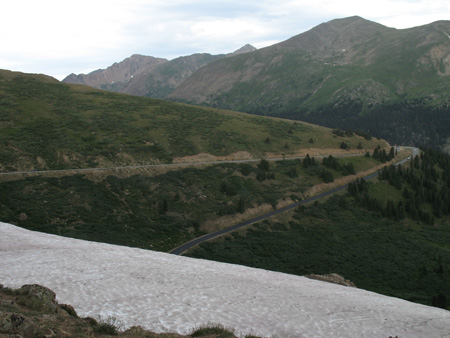
I took a 40 mile side trip up highway 82 to go over Independence pass. It was raining and hailing up there at 12000 feet.
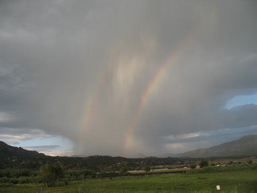
On my way to the hotel in Salida around 6 PM I found the first of many downpours of rain that I would ride through on this trip. I would hit rain somewhere everyday for the rest of the trip. I could have ridden away from this rain, but I had to stop to take pictures of the rainbow, and then downpour caught up with me.
August 3
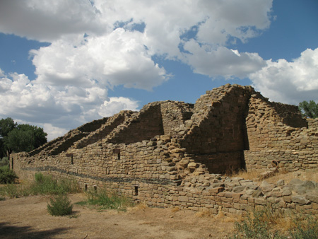
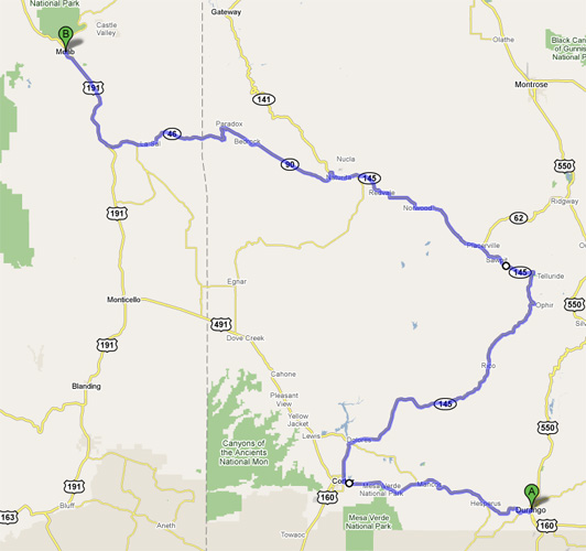
The goals for the day were to make it to Durango by sunset and start an attempt at my second National Parks Tour with a visit to the Aztec Ruins in Aztec, NM.
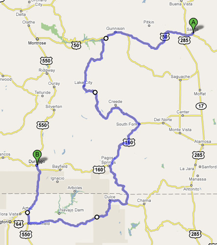
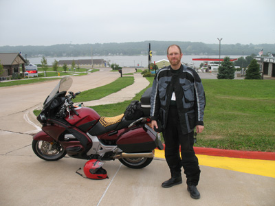
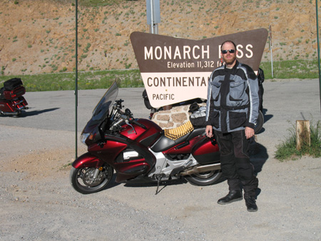
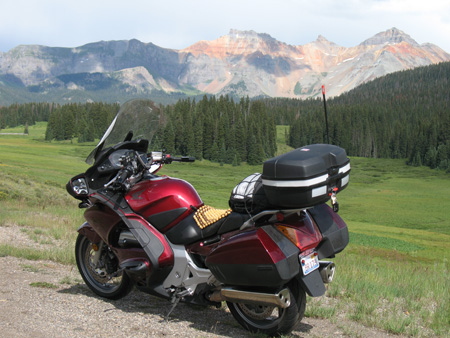
First stop was Monarch pass. I ran into a group of four on three Harleys, they took this picture of me. We chatted for a bit. The first question was: "Are those beads really comfortable?" This was the most asked question of the trip. Answer is: "Yes, absolutely. Best thing I have found for long-distance comfort." Then they saw the XM radio, GPS, SPOT, and driving lights. More questions..... They were planning on to be in Durango by evening, same as me. We half jokingly said, "see you there", not really believing that we would run into each other again.
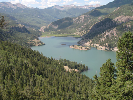
After Gunnison on highway 50, I headed south on highway 149. This is Lake San Cristobal.
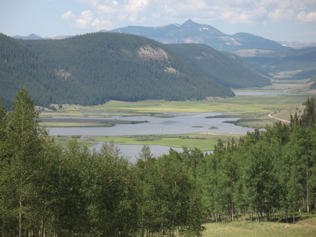
Next came the headwaters of the Rio Grande. There are still a few of the old ranches along the Rio Grande as it flows through the river valley. The more usual sight is one new house after the other lined up on both sides of the river.
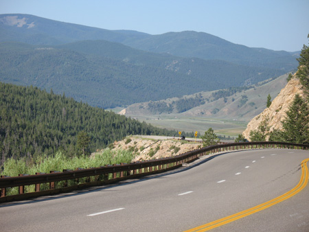
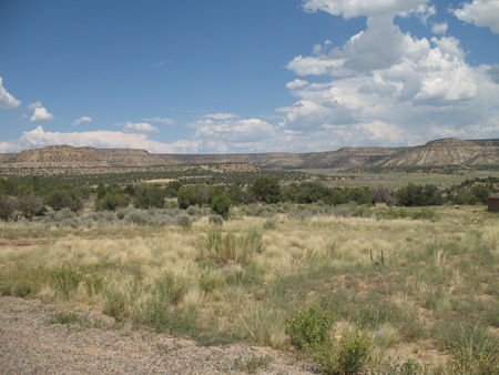
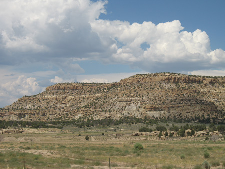
After South Fork, I continued south for a run through the northern edge of New Mexico. It was really interesting to see the steep Rocky Mountains give way to green fields, and then the cliffs and mesas of Mew Mexico. The road through the Carson National Forest area in NM is really remote. Nothing at all out there. Have a full tank of gas... Yes, it was HOT HOT HOT. (97 degrees)
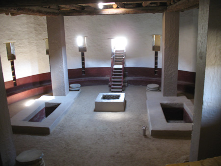
Finally Aztec Ruins National Monument. The second picture is the interior of a reconstructed ceremonial structure.
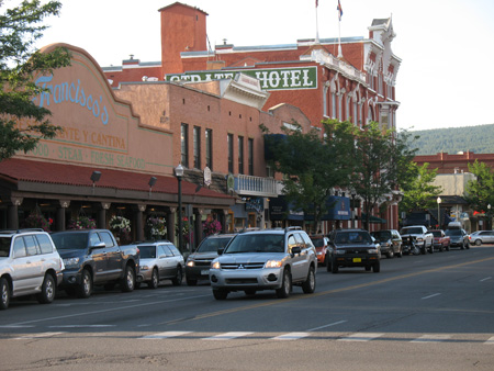
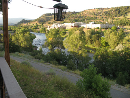
Up the road 35 miles (and through a downpour of rain) was Durango. I went to downtown Durango to see what was there. I was standing waiting to cross the street and I hear someone yell my name. It was the group I met at Monarch Pass in the morning. As we talked, it turns out that we all stayed at the Super 8 in Salida the night before and I parked my ST next to their bikes overnight. I then went to a BBQ restaurant that was right on the Animas River. As it turned out, if I had gone to the restaurant as soon as I got to town I would have met up with the folks from Monarch pass there too.
August 4
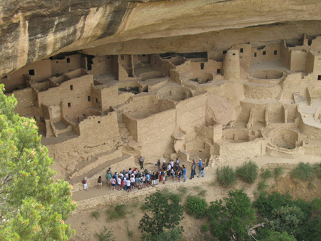
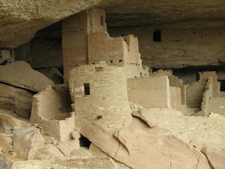
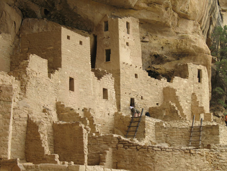
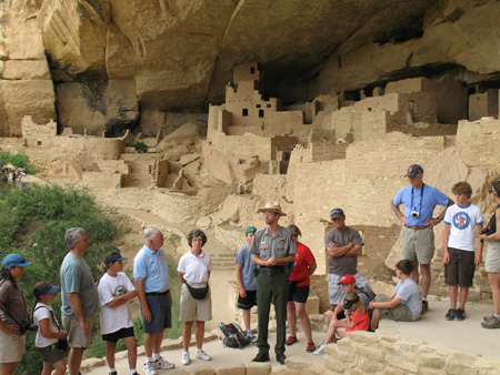
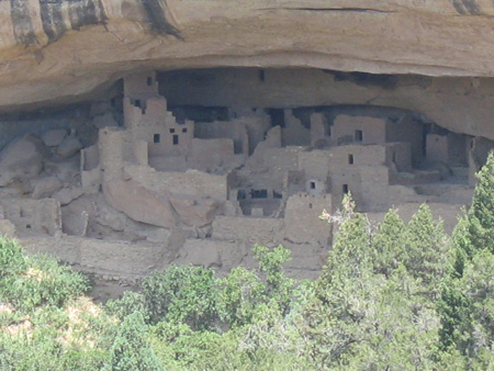
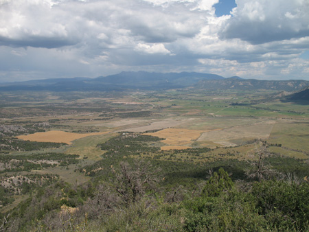
Started the day with Mesa Verde National Park. I took a tour of the Cliff Palace. Then drove around the main scenic drive and took a short hike to get a view of the Balcony House. Interesting to note that the Pueblo Indians lived on top of the mesa for over 600 years, then moved into the cliff dwellings around 1200. They abandoned them around 1300 and left the area, never to return. The theory is that there was a severe drought on the mesa around 1200, so the people moved to the water seeps that existed at the back of the cliff side caves. The problem was that the keeping the water supply clean was impossible when up to 20 people were living in a small cave area. Archeologists found evidence that the people were infected with parasites. The theory is that these problems forced abandonment of the cliff dwellings.
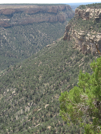
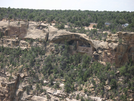
As I was about to head down from the mesa of Mesa Verde, I saw these amazing views.
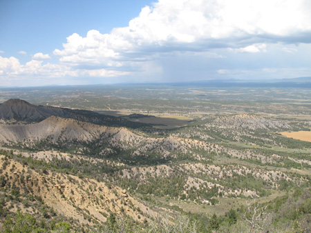
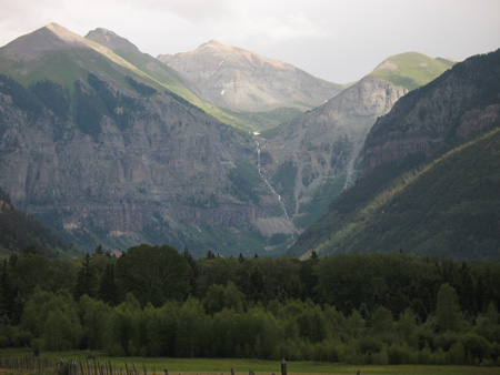
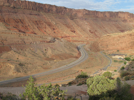
After Mesa Verde, I took a drive up the Million Dollar Highway from Cortez to Telluride. It starts out as a nice ride through a river valley, and then closer to Telluride the mountains just soar up.
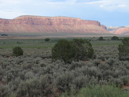
Heading west out of Placerville on Highway 145 goes through a very nice canyon (San Miguel Canyon I think). Then as I got near Paradox, CO came upon gorgeous red sandstone cliffs. All the flat land in this picture is for sale, mostly by Sotheby's Real Estate (the art auctioner to the rich and famous.) I do not want to know what the asking price is.
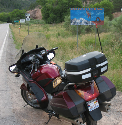
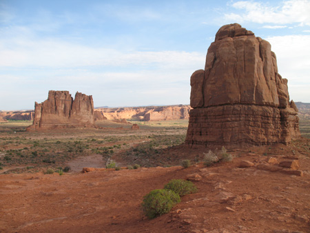
Next stop, the Utah border, and Hwy 191 heading to Moab. Simply gorgeous scenery.
August 5
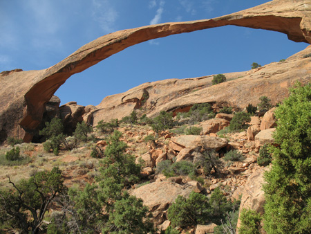
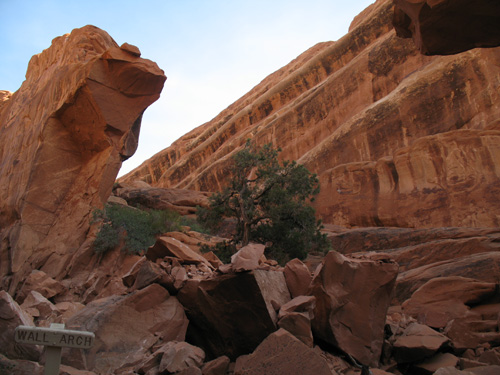
Since it was supposed to be nearly 100 degrees by afternoon, I headed out to Arches by 7:30 AM. I went to the Visitor Center and asked where to go for good views in morning sun. I was sent to the Devil's Garden trail to see the Landscape Arch, and Wall Arch. The Landscape Arch is a good first arch, very big and impressive. Then I went down the trail to the Wall Arch, and found a big pile of sandstone on the ground and a crushed tree that still had perfectly fresh green leaves still on it.. No more arch. I found out from another person on the trail that it fell down overnight. Obviously the ranger at the visitor center did not know about the collapse yet.
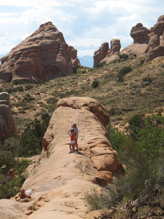
Then continued on down the trail as it climbs up over a couple of rock fins to reach the Double O arch.
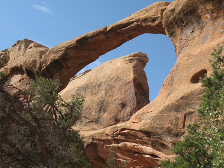
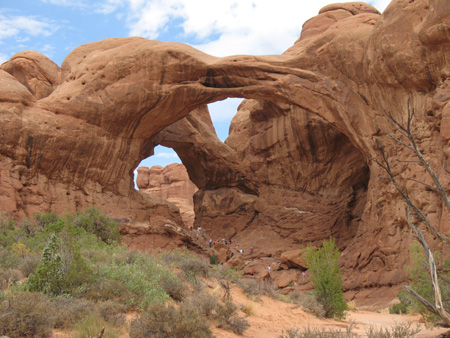
Here is another Double Arch in the Windows area of the park.
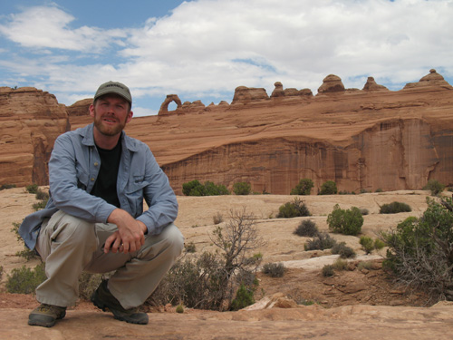
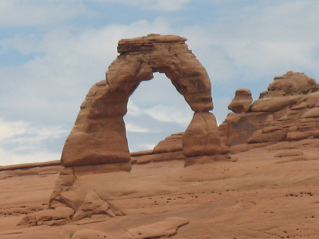
By this time it was after noon, and since I still wanted to get to Canyonlands park I did not take the 3 hour hike to the base of Delicate Arch. I went to the viewpoint trail instead.
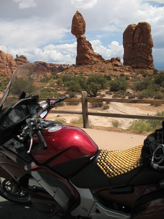
On the way out of Arches I stopped by Balanced Rock and some more great scenery.
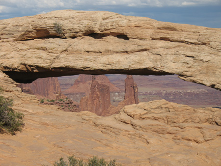
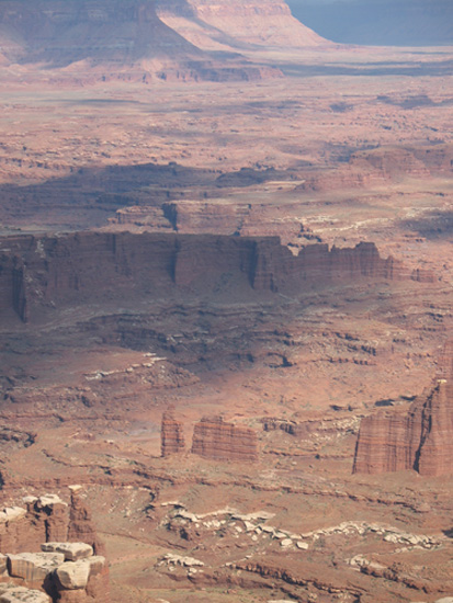
After a quick lunch back in Moab, it was off to Canyonlands - Island in the Sky district. First stop was Sheaffer Trail Overlook, then Mesa Arch.
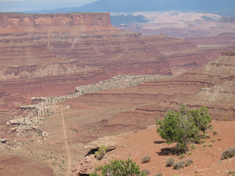
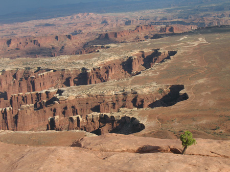
Then down to the end of the road to the appropriately named Grand View Point. I think it is the most spectacular view I have ever seen. I hung out there on the Rim Trail for at least two hours. While I was there a thunderstorm building out to the east. I could see lightning, and hear thunder rolling across the huge open expanses.
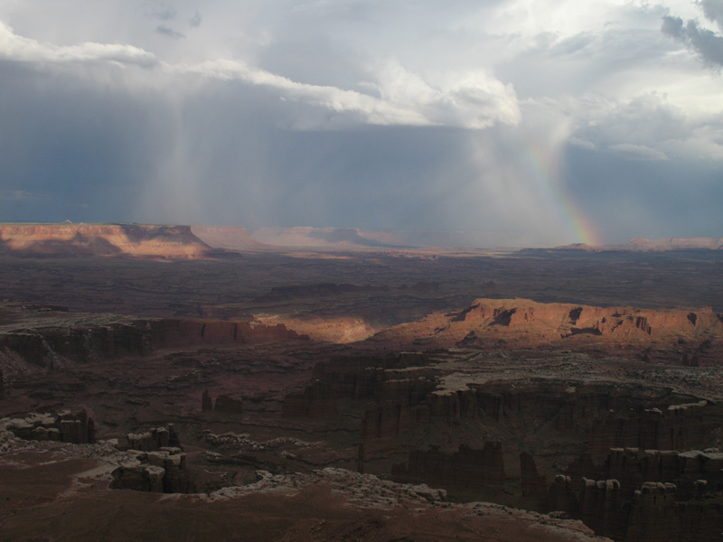
As I was just about to head out the sun came out in the west and a rainbow appeared.
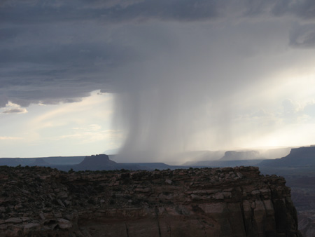
After I stood around and admired the rainbow for a while, I noticed this rain and thunder coming from behind me in the west. I decided I really better get moving. As I started the 30 mile ride back to the main road I ran into huge downpours of rain and saw rivers of water flowing through the desert. I was very worried about the lightning that was in the general area, but nothing ended up too close. One positive thing about the clouds and rain is that it really kept the temperatures down all day. It only made the low 90's rather than 100+.
The other surprising thing about Moab is the number of visitors from Europe, mostly Germany and France. Anywhere I went in Moab, and the two parks, practically the only languages I heard were German and French. There was some English being spoken, but it was very much in the minority.