The East Coast Trip – August 5 – 13,
2006
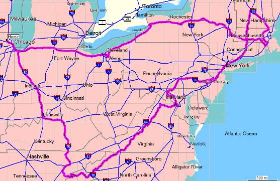
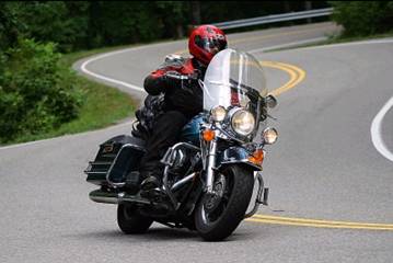
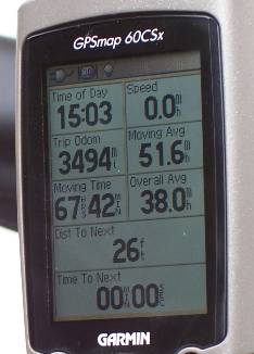
It is Sunday August 13, 2006 and I am just back from my big trip to the East coast. First the big news: My NPT is DONE! (pending certification). Doing 3495 miles in 9 days (actually 8 days of riding) was great fun. Here are some highlights and what I learned in the past week. The number one thing is that a GPS is great. (I realize that this is no surprise to everyone who already has one.) I installed it on the bike two days before I left. I needed to pick up 10 states and at least 24 stamps. Without the GPS I think I would have gone map crazy.
I headed out from the
The objective for Sunday evening was
Monday was supposed to be stamps in RI, CT and NJ. I got the RI stamp in
This is the
Tuesday was spent catching up with an old friend from grad
school who lives near
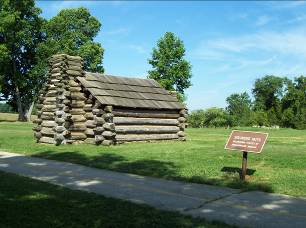
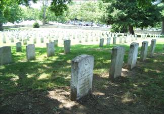
Wednesday was the big day for stamps and states: PA, WV, MD,
DC. Here is a
soldier’s hut at Valley Forge and the Cemetery at
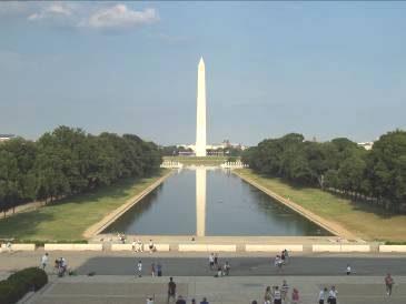
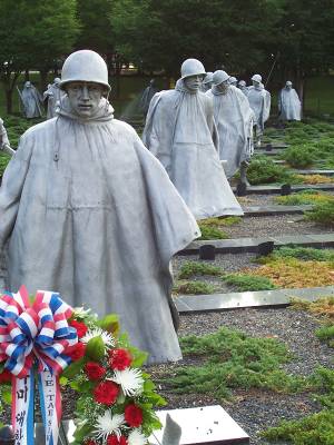
All went well until DC, where apparently the NPS has a staffing shortage and so some of the visitor centers are not open for their usual posted hours. I arrived at the Mall around 5 PM, and was making my way around the memorials. I was getting worried as some of the NPS kiosks were closed. I got to the Survey Lodge ranger station around 6 PM and could see the stamps just inside the locked door. It too should have been open, but was not. I was about to give up and was planning what it would do to me schedule to go back to downtown DC the following morning when I saw some NPS employees sitting at a picnic table nearby. It turns out that one the rangers was a “stamp collecting nut” (his words, not mine) so he understood my mission. He opened up the station for me so I could get my stamps. This put me one state (VA) and one stamp away from completion. The soldiers are part of the Korean War Memorial, and the other photo is obvious.
I went to the Manassas Civil War battlefield on Thursday morning for one last stamp. NPT was done.
Now that the need for stamps and states and timing visitor
center hours was done, I was set for the second part of the trip: A scenic ride
down
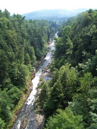
This is where the good weather ran out. There was a front
moving south, and I managed to keep pace with it (or it with me) for the next
three days on my entire run south. The
operative words are rain, clouds, and fog. Here is my view of the great
sweeping scenery of
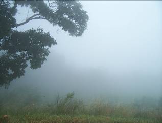
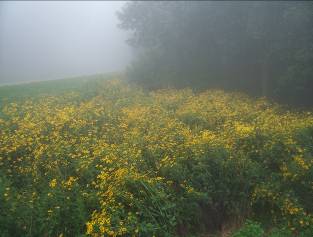
There were many times when visibility was less than 50 feet. From the moment I started down Skyline drive it was raining. Sometimes light rain, sometimes torrential downpours. Not a very fun ride.
By Thursday afternoon the clouds lifted a bit, and I could
see something, but nowhere near the grand vistas seen on the postcards. It did nothing to help my mood that the
Ranger at the
Thursday night saw me at MM 120 on the BRP at
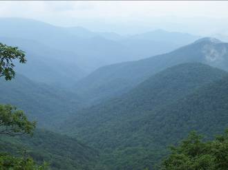
My best stop on the BRP was at Waterrock Knob overlook near the southern end. The sun was low in the west and looking to the east the ridges could be seen through the haze going off to the horizon shrouded with the most sublime shades of blue and green. An absolutely amazing sight. I have no picture to show, because it just would not come out anything like the real thing.
Friday night was spent in Cherokee, NC at the southern exit of the BRP. Of course when I arrived there it was raining.
Saturday morning dawned dark and rainy. The photo above is
from my hotel room window. Note the
clouds in the tree tops. I waited around the hotel for a while as I did not
want to leave in a downpour, but eventually realized that unless I wanted to
wait around all day, I just had to get going in the pouring rain. I went over to the Smoky Mountain Visitor
Center, but pretty much everything was in the clouds so there was no point in
driving up into the park, and with the pouring rain, not really good for hiking
around either. I headed towards Deal’s Gap in the heaviest
rain yet on the trip, hoping that the rain would stop long enough for me to
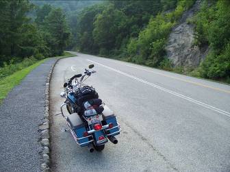
ride the gap. By the time I got to Hwy 28 the rain had paused. Highway 28 past
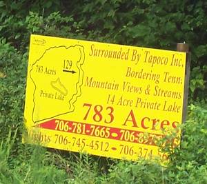
If you want to see Deal’s Gap in the rural state it is today, get there soon. Take a look at this sign just across the street from the Motorcycle Resort.
Yes, you read it right 783 acres for sale. You could build a small city on that. Basically it is all the land that borders the Deal’s Gap section of route 129. There are also about another 150 acres for sale around the other sides of the Motorcycle Resort. I suspect that the area is about to undergo explosive development and growth. I also wonder how much those who will likely spend big bucks on retirement homes and resort cottages will enjoy hearing screaming sport bikes and roaring cruisers go by every 20 seconds. OK, enough of the commentary.
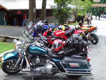
The rain did hold off long enough for me to go up and back on Deal’s Gap with some sections of pavement actually being dry. A very fun ride. After I got back to the resort I was thinking that those who just go up Deal’s Gap one way and say “Done that” miss most of the fun. After I knew what to expect the second run was much more fun that the first. Yes, I got the obligatory T-shirt and patch. There are now three photo companies that are lined up along the run, and at least one guy who will follow you down the road on a yellow wing that is equipped with multiple cameras and a DVD recorder so you can buy a video of your trip.
One funny story. While I was in the Resort shop, a guy next to me at one of the t-shirt racks was seeing only children’s sizes, and asked out loud to no one in particular, “Do they only have children’s sizes around here?” I answered him that at this store there should only be children’s sizes because us adults are only there because we are acting like children and playing with our toys. He got a good laugh out of that, and I heard him repeating it to his buddys shortly thereafter.
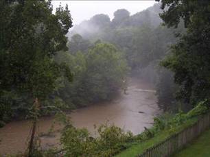
I then headed south on 129 toward the Cherohala Skyway. I can highly recommend that section of 129, a nice curvy road following the river. Not nearly as technical as Deal’s Gap, but a nice pleasant ride even considering that the pouring rain showed up again.
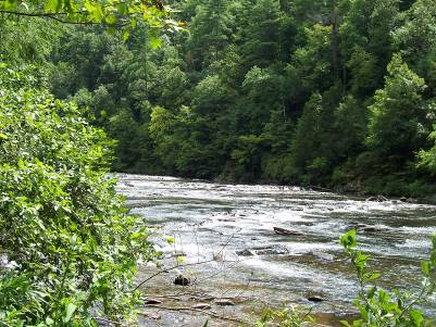
I am sure that the Cherohala Skyway is gorgeous, but for me it was mostly clouds, dense fog and heavy downpours of rain. See the picture of fog from Skyline drive for a general idea of the view. I will have to get back there someday when I can actually see something. Near the end of it by Tellico it stopped raining long enough for me to stop by the river and get a nice picture.
After all this rain, I was ready to turn for home. Quite frankly, after three days of twisting roads, I was actually looking forward to spending time on the superslab. (I guess I am a distance touring rider at heart.)
In summary, 9 days, 3495 miles, an NPT completed, and a whole new area of the country explored.
So, what can I say I learned on this trip:
- Burglar alarms can be very sensitive.
- I need a better rain suit. After three days in pouring rain, I know exactly where the leaks are on my current riding suit.
- The
West (Rockies,
- A GPS is a great tool, but it does not replace the need for a brain. It does not necessarily take you on the easiest route, just the shortest.
- Deal’s Gap is a great road to challenge yourself, but the other roads in the area are great for enjoying yourself.
- The NPT has taken me to many NPS sites that I would never have gone to otherwise, and I come away with a much deeper appreciation of our country’s history.